Six Days Alone in Algonquin: Canoe Lake to White Trout and Back
My first back country canoe trip of 2025 was to what is normally the busiest part of Algonquin. I left on May 4th from Canoe Lake and returned on May 9th to Canoe Lake. In between, I stayed on Rainbow, McIntosh, Misty, White Trout, and Sunbeam Lakes, each for one night.
The total distance for the trip was 99.07 km, as recorded on Strava. The way I recorded my days on Strava didn’t differentiate between paddling and portaging, but I did roughly 36.03 km of portaging. I double-carried each portage, so I did each portage length three times.
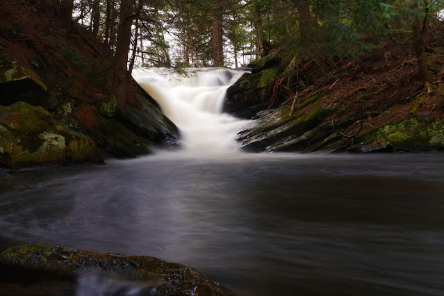 |
| Waterfall between Timberwolf and Misty Lake |
Day One – Canoe Lake to Rainbow Lake: 12.18 km, 4 hours 17 minutes
I recently got a new car this winter -a Chevy Equinox EV. Since this was my first time traveling with a canoe on the EV, I was interested to see how much it would affect my range. I left Ottawa at 98% and got to Bancroft with around 30%. From there, I charged up to 90%, which took 43 minutes, and arrived at the access point at Canoe Lake with 68%. It seems that having the canoe on the roof took roughly 5–8% off my range.
I got to the access point at 11:45 and was unloaded and ready to go by 12:00. Once I rounded the bend of the bay, I was hit by a headwind that lasted for the rest of my time on Canoe Lake. Canoe Lake is a strange place — it’s in the heart of Algonquin but feels much more like cottage country, with all the cabins and summer camps lining the shore. I was happy to leave it behind fairly quickly.
At the fork at the north end of Canoe Lake, I turned left and paddled up Potter Creek toward the portage leading to Maybe Pond. The 1,520 m portage started off nicely. There was a bit of snow still on the trail that I had to walk through, but once I crossed the road that runs parallel to Potter Creek, I entered a beautiful hardwood forest. There were so many yellow trout lilies it was hard not to step on them. The portage crossed a few wet spots, which is expected this time of year.
One downside of the portage is that it looks like you’re almost done when you reach a pond — but it’s a trick. You have to continue around the pond and then follow a creek upstream to get to Maybe Pond. This sounds relatively easy, but the portage just kind of ends at a random pond. I had to put down the canoe and bushwhack a bit to find the trail again, which was frustrating.
Once on Maybe Pond, I had to navigate around a few logs to reach open water. At the far end, there’s a short 50 m portage that connects to Rainbow Lake, but I was able to skip it with a pull-over across a bunch of logs — something that’s probably only doable with spring water levels.
Rainbow Lake has only one canoe-in campsite and two hike-in campsites, but they’re separated by a peninsula, so it feels like you have the lake to yourself when staying at the canoe-in site. It’s located about halfway up the eastern shore and faces west. The site is relatively small, with two tent pads and a central fire pit. The landing isn’t great — it’s steep and rocky — but it’s manageable.
The last person to camp at this site (likely last year) left behind a very generous woodpile, which I was quite grateful for. The day ended with a nice sunset, a subpar fire, and very calm water on the lake. This would be a great swimming spot in the summer, as the rocks drops off very quickly. Based on the untouched fire pit and lack of human footprints (only moose tracks on the portage), I believe I was the first person to complete this route this year.
 |
Charging my EV in Bancroft.
|
 |
| Old bridge on Potter Creek |
 |
| Road bridge over Potter Creek |
 |
| Snow on the portage into Maybe Pond |
 |
| Maybe Pond looking North |
 |
| My camp all set up on Rainbow Lake |
 |
| The campsite landing |
 |
| Enjoying a subpar fire and the sunset. |
 |
| Sunset on Rainbow Lake |
 |
| View from the campsite at sunset |
Day Two – Rainbow Lake to McIntosh Lake: 24.68 km, 8 hours 25 minutes
My second day in Algonquin started around 6:00 a.m. when I woke up. I was able to have breakfast and tear down camp by 7:30 a.m., which was great, as this would be my longest day of the trip. Once camp was packed up and I was in my canoe, I paddled over to the northern portage on the lake that leads out to Potter Creek. This northern portage is shorter than the southern one I did the day before, but I was continuing up Potter Creek, so the full portage ended up being 1,980 m long — which I double-carried. The trail had a lot of ups and downs and passed through both hardwood and pine forests. There was an MNR canoe stashed at the Rainbow Lake end of the portage.
Since I was the first person to use this trail this year, I had to deal with winter blowdowns. Most I could step over or go around, but I did have to stop at one point and cut through a fallen tree. Unfortunately, my saw handle broke in the process, though it was still usable.
Once I reached the road that serves as the portage between Potter Creek and Potter Lake, I went north toward Potter Lake. This road portion was the best portage of the day — flat, straight, clear, and quick. Potter Lake is a pleasant lake with a few nice campsites. At the far end, I had to deal with a beaver dam blocking access to the portage landing. This also meant dealing with a strong easterly wind and having to lift/pull my canoe over multiple small beaver dams to get into the small pond that houses the portage landing. During this process, I misjudged my footing and ended up thigh-deep in the beaver pond, which was not fun. Thankfully, I dried off quickly, and it was warm enough that I wasn’t too worried about the water temperature.
At the landing, I walked up a new set of stairs built by the park and was back on the same road as before — this time heading into Brûlé Lake. This portage was 730 m.
Once at Brûlé Lake, I had a quick lunch and then paddled against the wind to the western side of the lake, where the portage into Rosswood begins. The portage into Rosswood is a short 170 m but had a few good-sized trees along the trail. Once on Rosswood, I needed to head east — again against the strong easterly wind. It was manageable, but at one point the wind gusted so hard it spun me around backwards.
Once I managed to cross Rosswood, I reached the 1,000 m portage into Straight Shore Lake. This trail was similar to the previous one but longer. It passed through more nice hardwoods and some quite large hemlocks. Straight Shore itself was uneventful, but I understand why it’s named that — the eastern shoreline is remarkably straight.
At the far end of Straight Shore was my final portage of the day: 670 m into McIntosh Lake. This trail was very similar to the previous two, with a mix of good-sized trees and mainly hardwood forest.
Once on McIntosh Lake I had to deal with an Easterly wind again, this made paddling across the lake to my campsite difficult but not impossible. I had the choice of campsites on the Western end of the lake as I didn't see anyone else around. I ended up picking on which was nicely sheltered by trees and protected from the wind. It had a nice rock landing which made getting in and out of the canoe easy.
 |
| Rainbow Lake in the morning from the campsite |
 |
| Portage heading to Potter Creek |
 |
| Rainbow Lake from the portage landing |
 |
| Nice new set of stairs on the Potter to Brûlé Lake portage |
 |
| Brûlé Lake from the portage landing |
 |
| Stairs leading up to the road from Brûlé Lake |
 |
| Brûlé Lake at its narrow point |
 |
| Rosswood Lake |
 |
| Portage landing at Straight Shore Lake |
 |
| Straight Shore Lake |
Day 3 – McIntosh Lake to Misty Lake: 9.04 km, 2 hours 51 minutes
This day was purposely designed when I was planning the route, to be a short one — almost a rest day, but not quite. I didn’t get on the water until 9:30, but there was really no rush since I was only heading up two lakes. From my campsite, it was a short paddle over to the 410 m portage into Timberwolf Lake. This portage had some elevation changes, with a flat section at the top of the hill. There was a large white pine tree right at the McIntosh landing — a nice landmark.
As I started paddling across Timberwolf, I heard voices and soon saw the first people I’d encountered since Canoe Lake. Timberwolf is a nice lake with what looked like some great campsites as well. From there, you paddle up Timberwolf Creek to the portage into Misty Lake. It’s a short but steep trail at only 140 m. Along the portage, there’s a waterfall and a series of small drops — definitely worth checking out.
Once I was on Misty Lake, it started to mist — fitting, given the name. I paddled down the lake to the easternmost campsite, since it would give me a better starting point for the next day. The better campsites are all on the western end of the lake, but the one I stayed at had some really interesting historical artifacts. It looked like there had once been at least two building foundations, along with a bunch of old metal debris: a stove, oil drums, cans, wash basins, and what appeared to be a root cellar (though I didn’t go check it out).
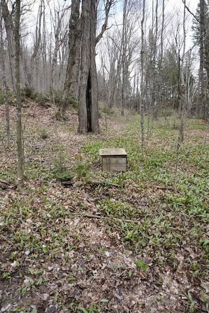
If you do camp here, be careful — there’s broken glass around, so it's best to keep shoes on. Behind the campsite, there’s a small stream that runs down the hill, adding some pleasant white noise for the night. The thunder box on the site was flooded, which was a first for me. Still, the site would be great in summer — it has a nice beachfront for swimming or relaxing. I ended up reading my book on said beach for most of the afternoon.
 |
| Site on McIntosh |
 |
| Little sign for the thunderbox |
 |
| My canoe on the McIntosh to Timberwolf portage landing |
 |
| Timberwolf creek |
 |
| A very helpful sign on Timberwolf Creek |
 |
| Another drop on the same portage |
 |
| Fire pit on Misty Lake |
 |
| One of two foundations and some old metal drums |
 |
| Trout Lilies |
 |
| Stream by the campsite on Misty |
 |
A flooded thunderbox
|
 |
| Beached canoe. |
 |
| Island view from the campsite on Misty |
 |
| Looking down Misty Lake |
 |
| Looking down Misty lake |
 |
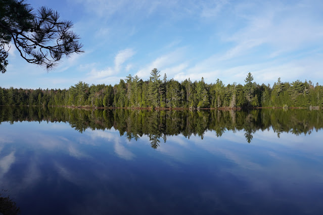
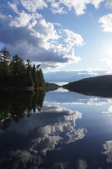
Reflections on Misty Lake
|
Day 4 – Misty Lake to White Trout Lake: 15.72 km, 4 hours 54 minutes
I woke up around 6:30 on the fourth day of my trip to a relatively dry campsite, which meant it hadn’t rained too much overnight — just a light sprinkle, it seemed. I got on the water around 8:30 and headed east to the far end of Misty Lake, toward the 850 m portage that bypasses an old dam and some rapids on the Petawawa River.
As I was approaching the portage, I saw something yellow. At first, I assumed it was the portage sign, but it turned out to be someone’s tent — they had slept right at the portage landing the night before. I started calling out “Hello!” a few times, since it was around 8:45 by then, and the last thing I wanted was to startle someone still asleep. After a couple of calls, the guy emerged from his tent and we exchanged good mornings. He mentioned he was heading to Big Trout that day — I really hope he made it, as I never saw him again.
The portage itself was rough. Mud everywhere, constant ups and downs, and at least two major blowdowns that I had to go around since the trees were too big for my small, broken-handled saw to manage. At one point, I came across a large mud puddle where someone had laid logs across to use as stepping stones. I gave it a try but underestimated how slippery they’d be — I ended up slipping and falling into the mud with the canoe still on my head. Aside from a few small scrapes and a big bruise on my leg, I was fine. But it definitely made me more cautious on this portage and the rest of the trip.
To top it off, I nearly stepped on a snapping turtle. I thought it was a rock at first, until I saw its head move. It had probably just emerged from hibernation and wasn’t fully active yet.
Once I got through that mess, the paddle down the Petawawa River was a nice break. The water was high, which allowed me to skip a low-water portage — I just had to duck under a sweeper to do it. On this stretch of river, I encountered my second group of people for the day — two canoes paddling upstream.
The rest of the portages along the Petawawa were short — 250 m, 150 m, 80 m, and 190 m — and mainly bypassed rapids and small falls. But since it was only a week after ice-out, the landings and put-ins were all mud baths. Every step was a squelch.
After the final portage, I paddled into what I initially thought was Grassy Bay, but it turned out to still be part of the Petawawa River — just a wide, open section. Once I rounded a point and was hit with a strong headwind, I knew I had entered Grassy Bay for real. This is where I spotted the obligatory moose of the trip, casually munching along the shoreline.
Eventually, I rounded the last corner and entered White Trout Lake, where I took the wind head-on again. My goal for the night was the U-shaped island in the middle of the lake. It took a while, but I made it.
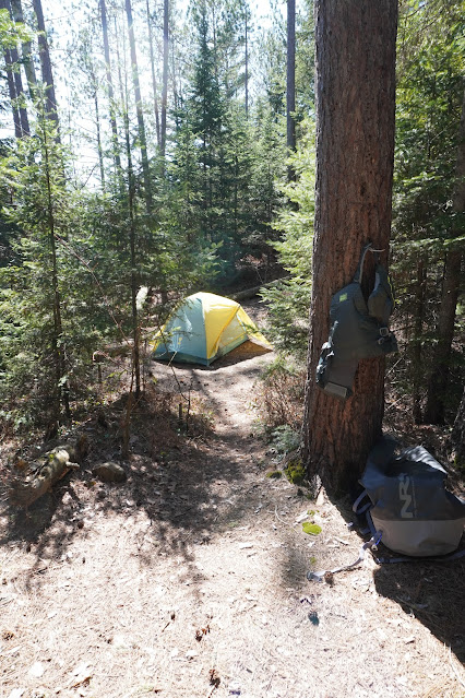
Once there, I set up camp and explored the island a bit. There's a trail that runs almost the entire length of it, offering some great views. This campsite would be amazing in the summer with how large and open it is — but on this day, I was getting hammered by the wind non-stop. It came straight down the lake and hit the island full force. That meant a cold, early night for me. I was in my tent by 7 p.m., just trying to stay warm and out of the wind. I made great progress in my book that evening.
 |
| At the 850M put on on the Petawawa River |
 |
| Cliffs on the Petawawa River |
 |
| Moose on Grassy Bay |
 |
| Campsite on White Trout |
 |
| Stairs up from White Trout to the campsite |
 |
| The other island site on White Trout |
 |
| My camp all set up |
 |
| Bench and a view |
 |
| The hill that overlooks the lake |
Day 5 – White Trout Lake to Sunbeam Lake: 17.79 km, 5 hours 42 minutes
On day five, I woke up around 6:30 and was on the water by 8:00. Due to the continued wind, I skipped a hot breakfast and coffee, opting for just a Clif Bar — I wanted nothing more than to get away from that wind. Thankfully, it was supposed to die down as the day went on.
For the first time on the trip, I had the wind at my back and made quick progress down White Trout Lake, through Grassy Bay, and into McIntosh Creek. I’m sure McIntosh Creek is easy to navigate in the summer, but at this time of year, it was not. It didn’t help that the first portage wasn’t marked with a sign. I ended up paddling past it and had to backtrack — against the wind — to find the proper landing.
The first portage didn’t start off great. About 50 m in, I had to put down my gear and pull out the saw to deal with a blowdown. The rest of the 940 m portage was actually quite nice, winding through hardwood forest and into pines. There was even a scenic little bridge over a creek.
Next was a short paddle across Hawkins Lake — I could see the next portage from where the previous one ended. Hawkins is a very pretty lake and, in my opinion, should have a campsite or two.
The second portage of the day was 1,330 m and split in the middle by a beaver pond that you canoe across. The first half of the portage was steep going both up and down, but after the beaver pond, it leveled out a bit. The small paddle across the pond was a nice break — it split what would’ve otherwise been a long slog into two more manageable sections.
Canada Jay Lake came next. It wasn’t particularly memorable, though the water did have a strange colour to it as I paddled toward the 870 m portage. That portage started out fine, passing through nice hardwood forest, but soon followed alongside a stream for the rest of the way. At one point, the stream widened significantly and almost looked paddleable. It was tempting, but thankfully I didn’t fall for it — I stuck to the trail and carried my gear all the way to Sunbeam Lake.
Sunbeam Lake is beautiful, and I could immediately see why it’s such a popular spot in the park. The site I got was the one with a small waterfall right beside it, which provided excellent white noise and something fun to explore. The campsite itself was quite nice and divided into three areas: the landing (small but pleasant), the main area up a hill with a fire pit and logs for seating, and a path that led to the only tent pad — big enough for maybe two tents placed close together.
As I was settling in for the night, I noticed that several groups were camping on the islands in the middle of the lake. That was disappointing, since the lake only has two official island campsites, yet it looked like almost every island was being used. It’s unfortunate for a few reasons, but mainly because people shouldn’t be camping on Sunbeam unless they’ve actually booked a site there.
 |
| Some helpful signs in Grassy Bay |
 |
| No sign for this portage |
 |
| Blow downs, the joys of early spring camping |
 |
| Bridge over the creek |
 |
| Hawkins Lake |
 |
| The landing landing on Hawkins leading to Canada Jay |
 |
| A short paddle over the beaver pond leads to the second half of the 1330M portage |
 |
| Another view of the beaver pond |
 |
| Canada Jay Lake |
 |
| Arrival on Sunbeam |
 |
| Tent pad on the site on Sunbeam |
 |
| Campsite on Sunbeam |
 |
| Up the hill from the water |
 |
| Small waterfall by camp |
 |
| Last fire of the trip |
Day 6 – Sunbeam Lake to Canoe Lake and Home: 19.66 km, 4 hours 46 minutes
The last day of my trip was short on portages but long on paddling — exactly how I wish most of my days had been.
I started my day just before 6:00 a.m., tore down camp, made breakfast, and was on the water by 7:15. Sunbeam Lake was glassy smooth as I paddled across, a perfect and peaceful send-off. I chose the Vanishing Pond route out of Sunbeam since it involved the fewest portages. The short 110 m carry into Vanishing Pond was quick and easy.
Vanishing Pond itself was beautiful, but I could see the bottom the entire way across — I can understand how this could be a problem later in the season when water levels drop. At the far end, I had to wiggle my way over a beaver dam to reach the creek. That creek had a total of seven beaver dams; only two caused me any trouble, but the real challenge was the winding nature of the creek itself, which made for slow progress in the middle section.
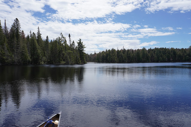
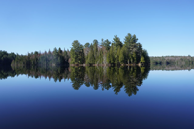
At the end of the creek, I reached the 380 m portage into Blue Jay Lake. Blue Jay was another stunning lake, perfectly calm and reflective — a real highlight, especially as it marked my final portage until the “Joe Lake highway.”
Once through Blue Jay, I paddled into Little Doe Lake, which had a number of really nice campsites — many of which were occupied, including by (I think) a school group. It must be amazing to go on a field trip to back country camp in Algonquin!
From there, it was one long, steady paddle through Fawn Lake, Teepee Lake, and Joe Lake, all the way to the final portage of the trip. The portage into Canoe Lake is famously referred to as the "Joe Lake highway," and I can see why — wide, flat, and busy with people coming and going. I made quick work of it and was soon on my final lake of the trip: Canoe Lake.
Although I hadn’t fished much during the trip — despite bringing all my gear — I decided to give it one last go on Canoe Lake. I hadn’t had a single bite all week, but, somewhat miraculously, I caught a 50 cm lake trout. At first, I thought I had snagged the bottom or hooked a submerged log, but to my surprise, it was my very first trout — a fantastic way to end the trip.
I made it back to the access point just after noon, following my fishing detour, and was on the road not long after.
For those curious about the EV logistics: my battery was at 65% when I left the access point. I drove down to Bancroft, arriving with about 45% remaining. I charged up to 82% in 30 minutes and made it home by 5:00 p.m. with 25% left in the battery.
 |
| Sunbeam in the morning |
 |
| Sunbeam in the morning with my canoe "Martin" |
 |
| Another view of Sunbeam |
 |
| My campsite landing on Sunbeam |
 |
| Vanishing Pond |
 |
| Vanishing Pond |
 |
| Vanishing Creek with a beaver dam |
 |
| Blue Jay Lake from the portage landing |
 |
| Blue Jay Lake reflections |
 |
| Little Doe Lake |
 |
| Another helpful sign |
 |
| Canoe Lake looking South |
Thanks for reading. Next Algonquin Trip is over Canada Day Weekend but am going front country camping twice before then so be sure to check out the blog for those photos.
Follow me on Instagram and Threads @iainwf


